


Somewhat drier start to the week, then wetter and muggier
Also looking at central Florida rainfall so far in June

The last week started off quite hot across central Florida with high temperatures in the mid 90s at the start of the week; the last few days saw more clouds around which knocked high temperatures down a couple of degrees in the lower 90s, still slightly above normal. With lots of humidity low temperatures have been running in the mid 70s all week, 3-5 degrees above normal.
As far as rainfall, overall rainfall across central Florida ended up fairly close normal for the week for most locations, with 1-2” amounts fairly common.

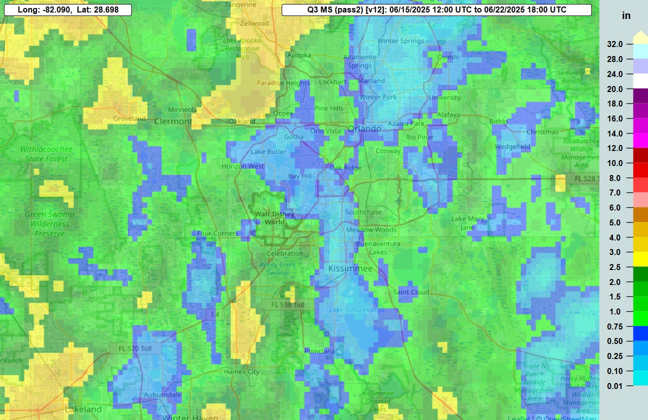
Interestingly, so far for the month of June, Orlando Int’l Airport (MCO) has only had right around 2” of rain, which is nearly 4” below normal month-to-date. However, as you can see on a map of radar estimated rainfall so far for the month, MCO is located within an unusually dry area for the region, while the area around Walt Disney World has seen 4-6” of rain this month, closer to normal. The area from west of of I-4 from Orlando over to Clermont has seen even heavier totals, with amounts over 10” in spots.

This week will start off with an unusually strong area of high pressure dominating all of the eastern United States. Some drier air working west on the south side of this system across Florida will bring slightly less humidity and lower than normal rain chances the next few days. While the coverage of storms should be lower than normal, there will still be widely scattered storms (20-40% coverage) each afternoon and what storms that form could be strong with gusty winds and frequent lightning. Be ready to move indoors if a storm approaches.
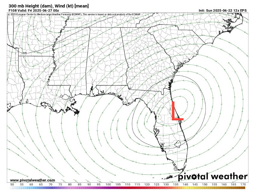
By late in the week, an upper level area of low pressure is expected to form across central Florida on the south side of the upper level high farther to the north. This will bring an increase in thunderstorm chances and humidity for the later part of the week, with storm coverage back into the 50-70% range. With more clouds and showers around, the forecast for the daytime highs will be a bit more uncertain, but overall should continue to average a bit above normal. With the increased humidity, heat stress will increase a bit as well - be sure to stay hydrated and take frequent breaks if in the parks or doing other outdoor activities.

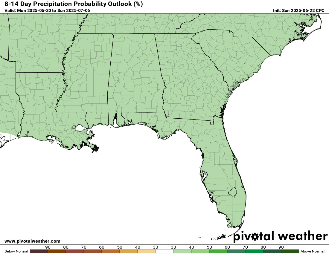
Looking ahead to week 2, as of now the outlook suggests that the pattern that sets up late this week will continue, with somewhat above normal temperatures and rainfall chances.

As far as the tropics are concerned, the National Hurricane Center is currently monitoring a weak area of low pressure east of Bermuda. Tropical development of this system is unlikely, and even if it were to become a tropical cyclone, it should remain weak and move northeast out into the open waters of the Atlantic. Right now there does not appear to be any tropical threats for Florida to be concerned about over the next 7-10 days.