
Increasingly active subtropical jet stream should bring more thunderstorm activity to Florida this week
NOAA seasonal hurricane outlook released, calling for a below normal season

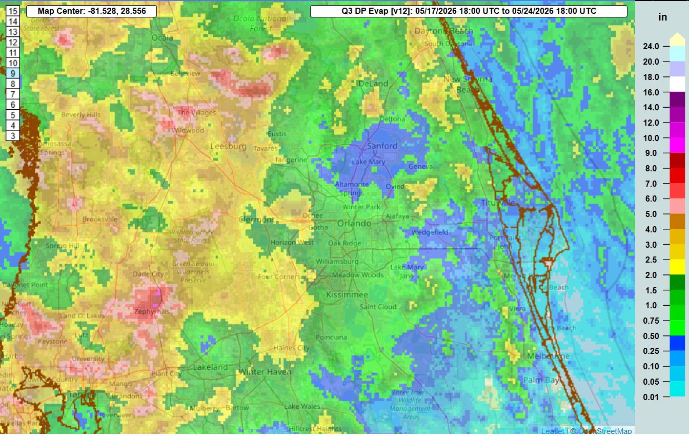
Easterly winds this week caused daily thunderstorm activity and the heaviest rainfall to be focused over the western half of the Florida Peninsula. Even with the most widespread activity to the west, most areas of central Florida picked up at least 0.5-1” of rainfall for the week. Temperatures were somewhat above normal with highs in the lower 90s each day, and morning lows were even a bit more above normal with lows in the 70 to 75 degree range each day. The low temperature on Thursday morning at Orlando Int’l of 73F tied the daily record warmest low temperature for the date.
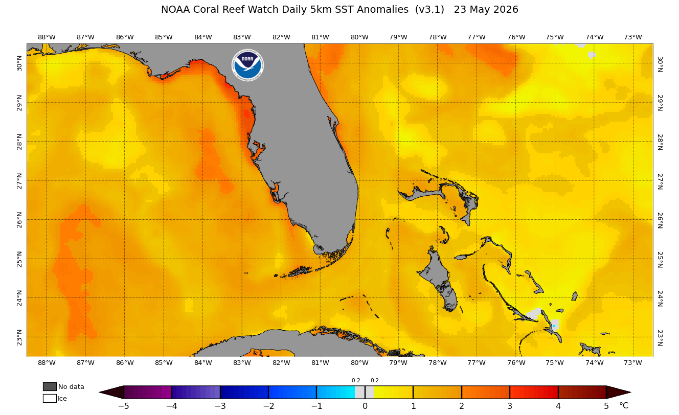
As I discussed last week, the significantly above normal sea surface temperatures surrounding Florida are helping to elevate humidity levels which is also keeping morning low temperatures warmer than normal.
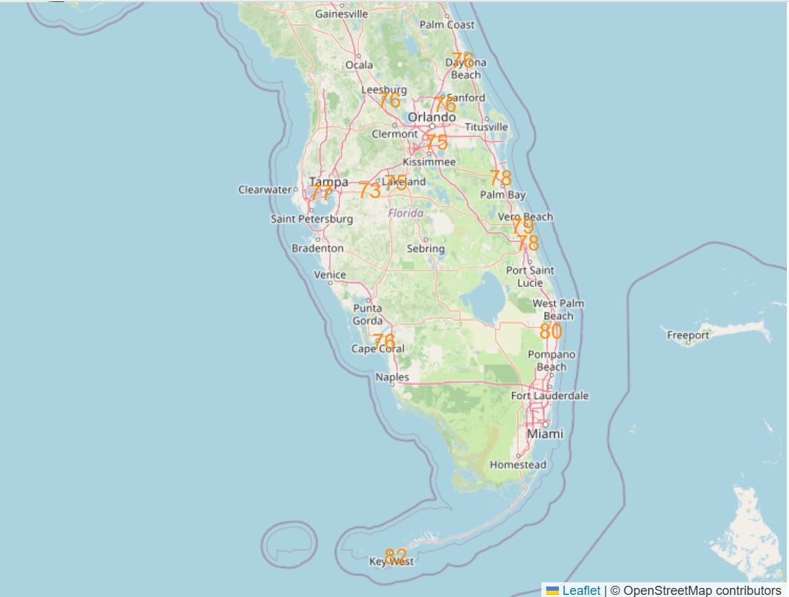
Morning lows will be near daily record warm levels at many sites around the Florida Peninsula this week (NWS forecast minimum temperatures near or above daily records for Tuesday shown above).
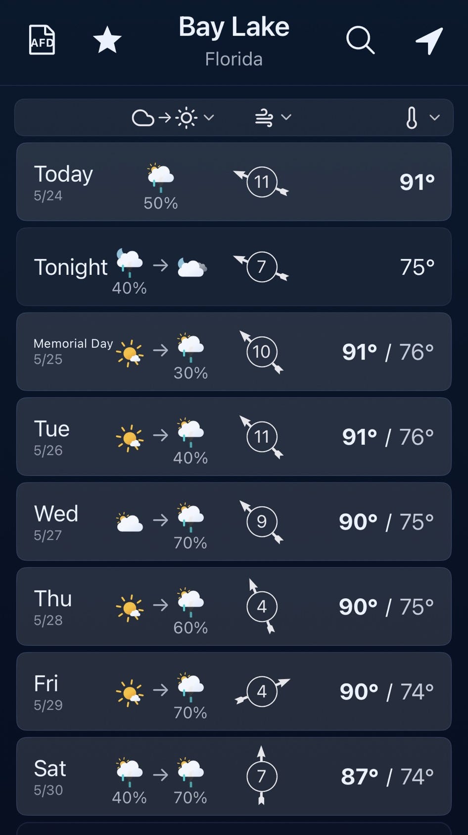
The southern subtropical branch of the jet stream has been becoming increasingly active across the southern United States the last several days, and this trend will expand toward Florida this week with increasing risks of showers and thunderstorms each day. Daily high temperatures should gradually come down a couple of degrees with the increase in clouds and precipitation — but humidity and morning low temperatures will remain well above normal. The bottom line for those planning to be in the parks this week will be to stay hydrated and be ready to move indoors if thunder is heard or threatening weather approaches.
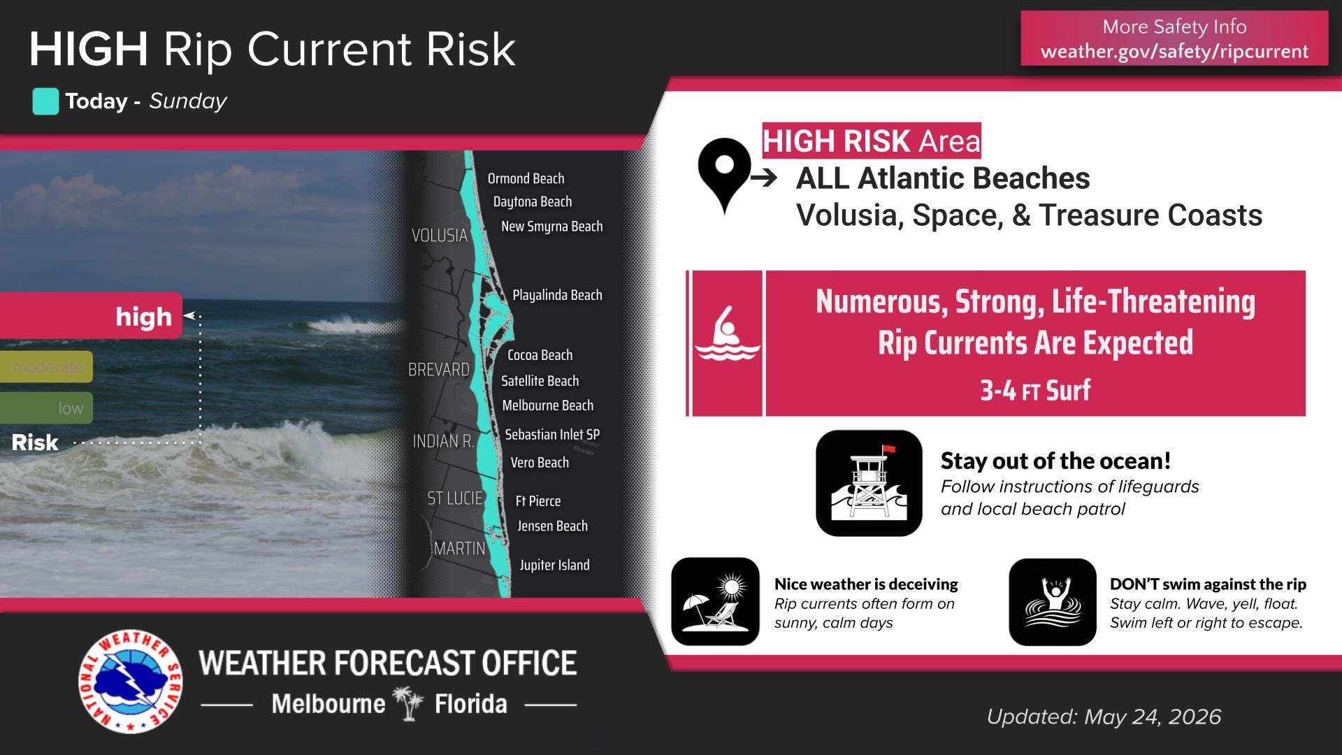
Strong easterly wind flow will continue to produce high surf and dangerous rip currents along the Florida East Coast the next few days. The persistent easterly winds should finally begin to relax later this week.
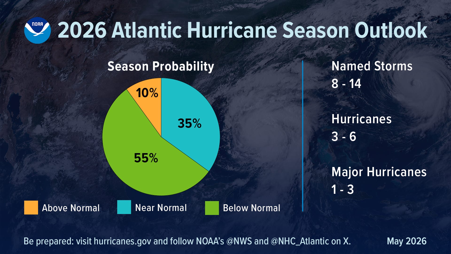
The seasonal hurricane forecast is always of interest, and NOAA released their outlook last week. It is calling for a below normal season to be the most likely outcome. This is due to the anticipated development of a potentially strong El Nino event — El Nino tends to suppress hurricane activity in the Atlantic, particularly in the Caribbean and deep tropical Atlantic. However, its impact on areas farther north is less consistent — and of course, it only takes one tropical system to potentially cause significant impacts to any particular region. I will be providing regular tropical updates in my Fairy Dust Forecast updates as we head into the 2026 Atlantic Hurricane Season.
Fairy Dust Forecast is a newsletter focused on providing weather information for those planning visits to central Florida theme parks or other outdoor activities in the region, as well as periodically sharing thoughts on Walt Disney World and other central Florida attractions from my GenX perspective. Regular weather updates are typically published on Sunday, with other occasional posts during the week. For $6/month, you can support Fairy Dust Forecast and get tailored weather information to support your specific vacation plans or other needs. Click below to become a paid or free subscriber. (Note that a paid Balanced Weather subscription includes paid access to Fairy Dust Forecast as well.)
It is dry down here in Orlando. The palm trees are losing their green. The ponds and lakes are visibly low.